|
Electronics
Once you understand Landfall's electrical
systems, we can talk more about the electronic devices or
"electronics" that the electrical systems power. These include
the GPS, steering systems,
radar and communication
devices. There are also silent communication
devices for general signaling, or for when all else fails.
Global
Positioning System (GPS)
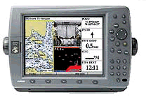
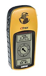
The most important of these electronic devices is the Global
Positioning System, usually referred to as the GPS. While we also
talk about GPS in the navigation tools
and navigation methods sections,
here we will cover how we use our GPS devices on Landfall.
To review, GPS works by receiving signals from three or more
satellites in geosynchronous orbit around the earth. In other
words, the satellites maintain the same position in relation to
the earth's rotation in their orbit. There are twenty-four of
these satellites in constant orbit around the earth. The GPS receiver
on the boat takes the data from these satellites to triangulate
the receiver's exact position on earth.
We can run a cable from the onboard GPS to send navigational
data back and forth to our computer. This allows us to use the
power of our laptop computer to store large amounts of data or
to build routes on our mapping software, and then transfer that
data back to the GPS. Some GPS models, including our main GPS
unit, have a built in "Map Plotter" which shows our actual position
on an electronic map.
We can also wire the GPS directly to the autopilot so that the
autopilot can keep us on a specific course or even turn the boat
at the right place.
Not only does the GPS tell us where we are, it can tell us where
we have been, how fast and in what direction we are moving, and
it can tell us what heading to steer to get to a specific destination.
There is also a "man overboard" feature. When this function
is selected, the GPS will tell us exactly what to course to steer
to track back from the way we just came, even if we were making
a number of turns along the way. This can be very useful if something
(or someone) falls overboard and we can no longer see it with
our eyes.
It takes a relatively long time to turn a sailboat around, and
often by the time the boat is turned, the waves have obscured
any object that is low in the water, like a person's hat--or a
person's head! And of course, it is almost impossible to see anything
on the surface of the water at night or in rainstorms.
We consider the "man overboard" feature to be one of
the more important safety features on Landfall. Because we will
be sailing many miles offshore, hundreds or even thousands of
miles sometimes, if one of us falls overboard, the GPS may be
the only thing that allows us to find the person and get him back
aboard.
Because the GPS is such an important safety device for so many
reasons, we carry several different GPS receivers on board as
backups in case something goes wrong with the primary GPS.
Steering
Systems
Autopilot for Sailboat's Wheel 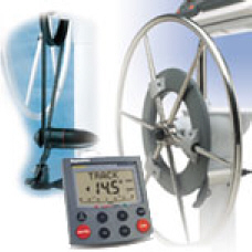
There are two ways to steer the boat without someone standing
at the wheel. One way is with the windvane, which is a mechanical
device that uses wind pressure to keep the boat on a constant
course in relation to the wind. We will discuss this more when
we get to mechanical systems.
The other way is using the electronic autopilot.
An electric motor connected to the ship's wheel drives the autopilot.
An electronic compass inside the autopilot sends a signal to the
autopilot's motor every time the boat starts to drift off the
programmed compass course. These course adjustments happen almost
constantly as the bow of the boat pushes through the waves. There
are buttons on the autopilot's control unit that allow us to change
the programmed course any number of compass degrees to starboard
or port.
Radar
Radar Antenna 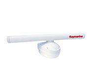  Radar Display
Radar is an electronic device that emits short pulses of microwave
radiation from an antenna. The radiation, like light, is reflected
by obstacles. The radar detects the reflected pulses and, from
the time delay between when the pulse was sent and the arrival
of its reflection, calculates the distance of the obstacle. This
process is repeated in every direction as the antenna scans the
horizon. The resulting information is displayed on a display screen
as a 360 degree pictorial representation of the area surrounding
the vessel.
Radar allows us to "see" other ships in the distance,
navigational markers, landmasses, and any large objects that may
be floating in the water. This is very helpful in avoiding collisions,
especially at night and during periods of rain and fog.
The radar system requires quite a bit of electricity to operate,
so many sailboats use a special instrument called a "Collision
Avoidance Radar Detector" or "CARD". Large commercial ships operate
their radar systems continuously. The CARD detects the sound waves
sent out by these ships' radar and sounds an alarm on the smaller
boat, alerting them that a large ship is approaching, and from
what direction.
The biggest danger to a small boat at sea is being run over by
a large ship. The CARD alarm allows the crew on the smaller boat
to steer clear before the larger ship gets too close for comfort.
Radios
Mounted VHF Radio 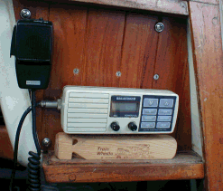
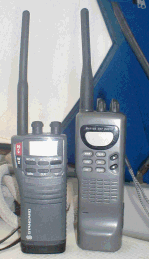 Handheld VHF Radios
There are three types of two-way radios that are commonly carried
on vessels. The most common radio is a marine "VHF" (very high
frequency). Almost all vessels around the world carry a VHF radio,
so no matter where you are you can communicate with other boats
in the vicinity. The drawback to marine VHF is its relatively
short range of 5-25 miles. So while VHF is good for talking to
nearby vessels, it is of no use to talk to people on vessels far
away.
The second common type of radio is called a "single-side band"
radio, or "SSB". Single-side band has a much greater range than
VHF and it is almost as easy to operate. The drawbacks to SSB
radios are that they are expensive to buy, and they require a
lot of space for the radio equipment and antenna shielding.
The final type of radio commonly used on vessels is the "ham"
radio. Basically, ham radio allows you to send a signal and talk
to another ham radio operator anywhere around the world. It can
also send data, allowing you to log on to the Internet or send
and receive email. Unfortunately, these ham systems are complicated
to operate (requiring a special license from the FCC, or Federal
Communications Commission), they are very expensive, and they
take up a lot of space.
There are other less common (and more expensive) forms of communication
that can be used on vessels. These use satellites for transmitting
the data.
Emergency
Locator Beacons
EPIRB 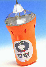
An important safety-related battery operated electronic device
called an "Emergency Position Indicator Radio Beacon" (EPIRB)
is carried on many boats. The EPIRB is designed to send out a
long-range distress signal in the event of a life-threatening
emergency or if the crew has to abandon ship at sea. When activated,
the EPIRB broadcasts a unique, repeating SOS signal that can be
detected from virtually any point on earth. When properly registered,
the signal includes a description of the vessel and its location.
This critical information is routed directly to rescue units on
the ground, reducing search time dramatically. It is recommended
that sailors venturing outside reliable VHF radio range, about
20 miles offshore, carry an EPIRB on board. The signal is transmitted
on a frequency constantly monitored by rescue services and commercial
airliners around the world. Even if not properly registered, the
outgoing signal includes the serial number of the device and its
location in latitude and longitude. The serial numbers of all
EPIRBs are registered with the Coast Guard, so that they can identify
the vessel in trouble.
Landfall carries a VHF radio, GPS, radar, an autopilot, and an
EPIRB.
Silent
Communications
Signal Flags
Radio devices that can be carried aboard vessels are not our
only means of communication. Time-honored methods used to send
signals to other vessels are still in common use today.
 |
If you go to any seaport, you will see boats flying flags.
The flag on the stern of a boat is the flag of the nation
where the boat is registered. For instance, Landfall is
registered in the United States, so we fly the American
flag from her stern. If we were visiting a foreign port,
then we would fly a second flag from the side of the mast.
That flag would be the national flag of the country we are
visiting.
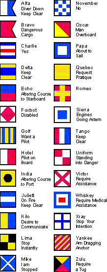
There are also 37 different signal flags,
shown to the left. A signal flag is used to send a message
to other boats. These flags are of all different designs
and colors. In fact, there is a different flag for every
letter of the alphabet and for each of the numbers 0-9.
To send a message, you simply use the flags representing
the letters and numbers to spell out the message, and hoist
the flags up the mast.
Only a few colors can be readily distinguished
at sea. These are: red, blue, yellow, black, and white;
that is why these flags use only these colors. The captions
beside each flag describe the letter the flag stands for
as well as the international signal it represents.
Notice that the flags aren't named after the standard ABCs.
Instead, they use the International Radio Operators Alphabet,
also sometimes called a phonetic alphabet. Which, since
they are transmitting a signal, is very appropriate.
We also use this alphabet when talking on the VHF radio,
if there is a lot of static.
The solid yellow flag is commonly called a quarantine flag.
The quarantine flag is used to notify the customs officials
of a new port that you have just entered their waters. Once
the customs officials have cleared the ship and crew (admitted
them into the country) the quarantine flag is taken down.
|
Running Lights
All boats are required to show "running lights" when underway
at night. These lights are set up in a standard pattern so that
other vessels can tell what type of vessel you are and in what
direction you are traveling. There is a red light on the port
bow, a green light or the starboard bow, and a white light on
the stern. So when it is hard to see other boats at night, if
we look out from the port bow and see the green light of another
ship, we know that we are going to cross paths and should take
care. If we look in that same direction and we see the vessel's
red light, we know that the other ship is moving away from us
and we are safe. If we look out from our starboard bow, the colors
would mean the opposite.
The simple rule is that if we are looking over either our green
or red light and see the opposite color on an approaching ship,
then we will cross paths. If we see the same color as the light
we are looking over, then we are moving away from each other and
we are safe.
Signal Flares
We also carry signal flares on Landfall. Signal flares are used
in the event of an emergency, to let nearby vessels know that
there is a vessel in distress.
|
![]()